Counties

The six counties

NORPACRRO works within six counties in Kenya's North Rift and their borderlands. The notes below describe the shared context in which our programmes operate.

Each county below has its own administration, its own county government priorities and its own community institutions. What they have in common is a pastoralist or agro-pastoralist economy, a dryland environment, exposure to recurring drought, and - for several - borders that connect them to neighbouring counties, countries and rangelands.

On the numbers: where a statistic would normally be cited in a county profile, this site shows [PLACEHOLDER: statistic to be confirmed] rather than an unverified figure. County profiles will be published with sourced data only.
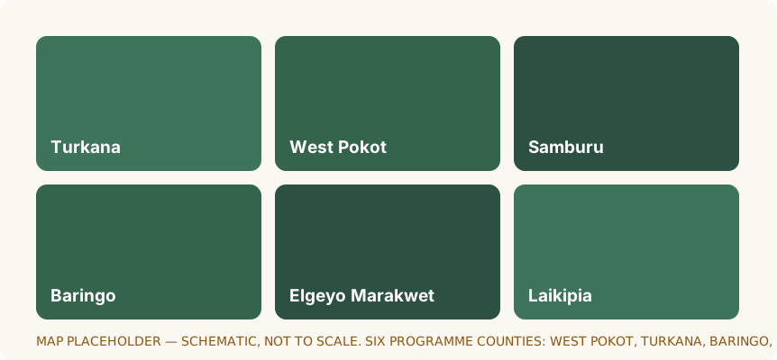
Schematic placeholder map of the six programme counties
Schematic map of the six programme counties. [PLACEHOLDER: final geographic map showing sub-counties, programme sites and office locations]
Placeholder glyph representing West Pokot County

West Pokot County

[PLACEHOLDER: county population, land area and ASAL classification to be confirmed]

West Pokot County lies in the North Rift along Kenya's western border, within the country's arid and semi-arid lands. Livelihoods are dominated by livestock keeping among Pokot pastoralist communities, with crop and horticultural farming in the cooler highland areas around Kapenguria and along the Kerio Valley. Rainfall is unreliable, and dry spells regularly reduce pasture and water availability for herds. The county also experiences flash floods and landslides in its highland areas. Seasonal movement of livestock across the border with Uganda is a long-established part of local pastoralist practice.

  • Arid and semi-arid
  • Pastoralist
  • Kenya-Uganda border
Placeholder glyph representing Turkana County

Turkana County

[PLACEHOLDER: county population, land area and ASAL classification to be confirmed]

Turkana is Kenya's largest county by land area and one of its driest, lying in the far north-west of the country. The Turkana pastoralist economy is based on livestock keeping, with camels, goats, sheep and cattle adapted to a hot, arid environment; fishing and lake-based livelihoods are also important along Lake Turkana, the largest desert lake in the world. The county borders Uganda, South Sudan and Ethiopia, and cross-border movement of people and herds is central to how livelihoods work here. Recurring drought, high temperatures and long distances to services shape day-to-day life for most households.

  • Arid
  • Lake Turkana
  • Cross-border
  • Livestock and fishing
Placeholder glyph representing Baringo County

Baringo County

[PLACEHOLDER: county population, land area and ASAL classification to be confirmed]

Baringo County sits in the North Rift and includes both semi-arid lowland rangeland and productive lake shorelines around Lake Baringo and Lake Bogoria. The county is home to pastoralist and agro-pastoralist communities, including the Tugen, Pokot and Ilchamus, for whom livestock keeping and smallholder farming are the mainstay. Dryland conditions, variable rainfall and pressure on grazing land make households vulnerable to drought, while flooding around the lakes has displaced settlements in recent years. At times, insecurity has constrained movement and market access in parts of the county.

  • Semi-arid
  • Agro-pastoralist
  • Rift Valley lakes
Placeholder glyph representing Samburu County

Samburu County

[PLACEHOLDER: county population, land area and ASAL classification to be confirmed]

Samburu County covers a large, arid and semi-arid expanse in Kenya's northern rangelands. The Samburu pastoralist economy is built on cattle, goats, sheep and camels, with livestock movement following water and pasture across wide areas. Community conservancies and tourism operate alongside pastoralist land use, and wildlife is a significant economic and ecological feature of the county. Rangeland degradation, drought and human-wildlife interaction all shape household prospects, and access to schools, health care and markets requires long travel.

  • Arid and semi-arid
  • Pastoralist
  • Community conservancies
Placeholder glyph representing Elgeyo Marakwet County

Elgeyo Marakwet County

[PLACEHOLDER: county population, land area and ASAL classification to be confirmed]

Elgeyo Marakwet County spans the highlands of the Cherangani Hills and the steep Kerio Valley floor, giving it unusually varied conditions for the North Rift. Marakwet communities are known for long-established irrigation furrows that carry water to valley farms, while the highlands support intensive mixed farming and the valley is largely agro-pastoralist. The county forms part of a critical water catchment for the wider region. Steep slopes and heavy rain bring landslide and erosion risk, and the valley's geography has historically complicated movement and service delivery.

  • Highland and valley
  • Agro-pastoralist
  • Water catchment
Placeholder glyph representing Laikipia County

Laikipia County

[PLACEHOLDER: county population, land area and ASAL classification to be confirmed]

Laikipia County is a semi-arid plateau in Kenya's Rift Valley that sits between the highlands of Mount Kenya and the drier country to the north. Land use is a mosaic of large-scale ranches, group ranches, community conservancies and smallholder settlements, with pastoralist and agro-pastoralist communities raising cattle, goats and sheep alongside commercial livestock production and wildlife conservation. Rainfall varies sharply across the county, and dry periods affect pasture, water and the terms on which smallholders can sell animals. Wildlife and livestock share much of the same land, which shapes how herders plan movement.

  • Semi-arid
  • Ranching and conservation
  • Pastoralist and smallholder

Borderlands

Pastoralist livelihoods in the North Rift do not stop at a county boundary. Herders move seasonally between counties and across international borders in search of water and pasture, and the markets, kinship networks and grazing agreements that support them cross those lines too.

NORPACRRO therefore plans its work at rangeland scale where necessary, coordinating with county governments on both sides of a boundary, and takes account of cross-border dynamics when designing interventions and when assessing risk.

Cross-border coordination arrangements: [PLACEHOLDER: details of cross-border agreements and partner county governments]